Hiking up Langbiang Mountain in Dalat: An Adventurous Journey
- HipsterHobo
- Jul 11, 2024
- 4 min read
When we were in Dalat, we craved something more active than just strolling through the sometimes crowded city. With the fresh mountain breeze and cooler temperatures, hiking up Langbiang Mountain seemed like the perfect adventure. Langbiang is located about 25 minutes by car or motorbike from Dalat, making it easily accessible for a day trip.
About Langbiang Mountain
Langbiang Mountain is a well-known destination in Dalat, famous for its panoramic views and lush landscapes. The mountain is named after the legend of a couple, K’lang and H’biang, whose love story is a local tale of Romeo and Juliet. The mountain consists of two peaks: Radar Peak and Langbiang Peak, with the latter being the highest at 2,167 meters above sea level.
Many tourists take jeeps up to Radar Peak for a scenic view, which stands at about 1,950 meters. However, the real adventure is hiking to the actual Langbiang Peak. This hike is about 6 kilometers long and can take around 3 to 4 hours one way, depending on your pace and fitness level.
Getting to Langbiang Mountain
We had our own motorbike, which we bought in Ho Chi Minh City. After a hearty breakfast, we packed our essentials, which were water, a raincoat and some extra food, and set off for Langbiang Mountain. If you're not experienced with driving a motorbike in Vietnam, it's better to opt for a Grab taxi. You can read about our first motorbike experience in Ho Chi Minh City in our other blog article.
Part 1 of Hiking Langbiang Mountain: The start
When we arrived at the entrance, we parked our motorbike for 10,000 VND (less than 0.5 USD). Instead of entering through the main gate where there's an entrance fee, we took a dirt road to the right, which was free of charge. The beginning of the hike was easy with a flat surface, but soon we encountered a sign that said "up the mountain." The climb began immediately with a steep red dirt path.

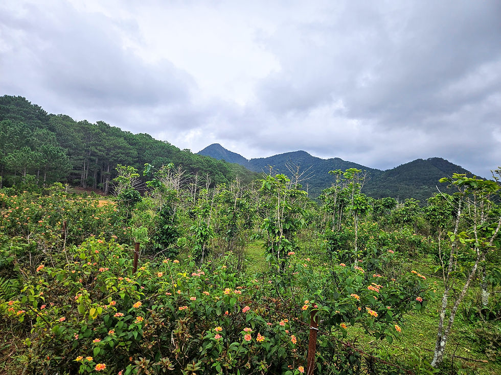
Passing a sign with a skull that warned it was dangerous to proceed, we knew we were on the right path, since we read about this in other reviews. We walked through coffee plantations until we reached a forest of mostly pine trees. The air was filled with the fresh scent of pine, and the occasional bird song added to the serene atmosphere. Another sign pointed us up the mountain, reassuring us we were still on track. The path was generally clear, but at some forks, it was best to keep right.
As we climbed through the pine forest, the terrain became increasingly steep. The workout was intense, but the surrounding beauty kept us motivated. We met a few fellow hikers along the way, all equally enthusiastic about the journey. Some were locals who shared stories about the mountain's history and legends, adding a cultural layer to our adventure.
Part 2 of the Hike: Decision Time
Eventually, we reached the road used by jeeps. At this point, we were above 1,800 meters and roughly halfway there. We took a moment to catch our breath and admire the view, which stretched out over the lush valleys and distant hills. We had a choice: follow the road to the tourist viewpoint or take a right and hike to the peak, which is about 250 meters higher.
Determined to reach the top, we took a short break and then continued to the peak. Initially, the trail was easy, but soon we had to descend a little, and the terrain became rougher. Entering a more jungle-like area, the climb resumed. A sign indicated we were 970 meters from the top, giving us false hope, as we later saw a sign saying 710 meters after hiking much further.

The last part of the hike was the toughest: steeper and more challenging. The path became narrower, and we had to navigate around roots and rocks. The moist environment meant there were leeches, so we kept an eye out and brushed them off as needed. Despite the difficulties, the sense of adventure kept our spirits high.
Reaching the Peak
Finally, after what felt like an eternity, we reached the top. Unfortunately, the view was obscured by clouds, but the feeling of accomplishment was unmatched. We had made it to 2,167 meters, the highest point of Langbiang Mountain. The summit was quiet, with only the sound of the wind and our breathing.

We spent a few moments taking in the atmosphere, snapping a few photos, and having a well-deserved snack. The clouds parted briefly, offering a glimpse of the breathtaking landscape below. Although the view was fleeting, it was a reminder of why we embarked on this journey.
Conclusion
Hiking Langbiang Mountain is a great adventure for anyone visiting Dalat. The journey is challenging but offers a sense of accomplishment and an escape from the city's hustle. The trail is full of natural beauty and a few surprises along the way, making it a memorable experience. If you're up for it, pack your essentials and head out for a hike you'll never forget!
If you found this article helpful, don't forget to check out our other blogs on our Travel Blog Page. And while you're at it, we also made a Travel Apps Page, which has reviews on the latest Apps for traveling!
Comments